


Google Maps has started displaying demarcated containment zones in Mumbai. The latest change comes through the ‘COVID-19 Info’ layer that Google launched globally a couple of weeks back to colour code the areas infected with COVID-19 cases. The search giant said in a statement that it was working closely with Brihanmumbai Municipal Corporation (BMC) for sourcing information about containment zones in the city. Earlier this year, Google Maps received an update to bring the ability to search for COVID-19 testing centres in India.
With the new update, Google Maps users in Mumbai can get details of containment zones in their city. The feature is available on both Android and iOS devices and is a part of the latest Google Maps release.
“As people and businesses emerge from the lockdown, access to clear information about COVID-19 containment zones as recommended by the authorities in Mumbai will enable users to make better decisions as they move around the city,” a Google spokesperson said in a prepared statement.
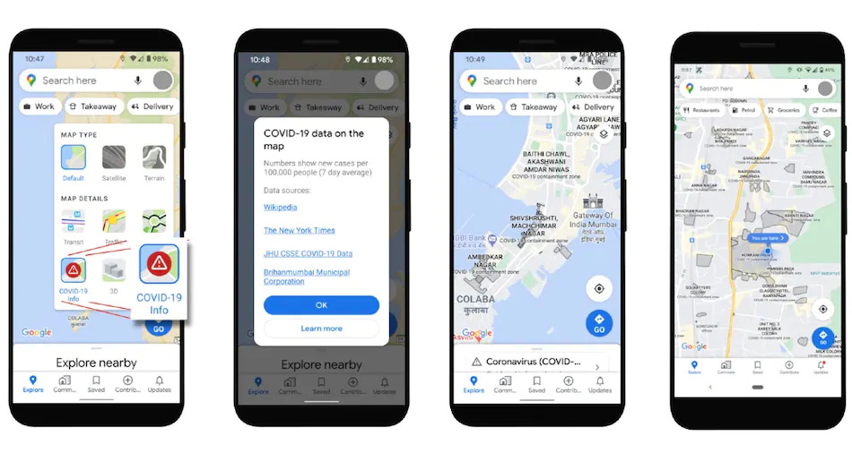
Although the new update is limited to Mumbai, users in other cities across India can also leverage the newly launched COVID-19 Info layer on Google Maps to access state-level COVID-19 statistics. The layer overlays the number of new COVID-19 cases (on a seven-day average) indicated per 1,00,000 users. The trend in the number of cases in that state can be seen when a user zooms out to view their entire state.